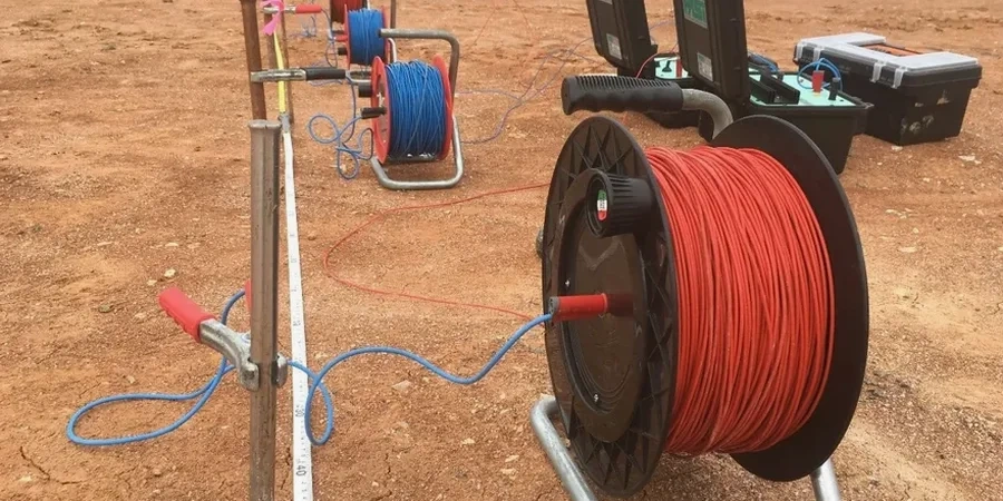
Tucson’s expansion from a Sonoran Desert outpost into a sprawling metropolitan area of over half a million residents didn’t just strain water resources—it pushed geotechnical investigation into terrain where conventional drilling hits caliche layers that stop augers cold. That’s where non-invasive methods earn their place. In the Tucson basin, the contact between Quaternary alluvium and the underlying Pantano Formation or bedrock can shift dramatically across a single parcel, and guessing at it from surface mapping alone introduces unnecessary risk. We run vertical electrical sounding (VES) arrays that measure apparent resistivity at increasing electrode spacings, building a one-dimensional model of subsurface layering without a single excavation. For projects near the Santa Cruz River or on the bajadas sloping off the Catalina foothills, the data tells you where saturated zones begin and how deep competent bearing material lies. When the results suggest buried channel deposits or perched water, we often recommend pairing the survey with a targeted CPT test to ground-truth the geoelectric boundaries with continuous cone resistance data.
A VES sounding across desert basin-fill in Tucson can resolve the water table within 4 percent of borehole truth—but only if the inversion handles the near-surface caliche spike correctly.
Local ground factors
One thing Tucson geotechnical practice teaches you fast: dry desert soils are not electrically the same as moist desert soils, and a resistivity profile run in June can look very different from one run in February after a winter rain cycle. We see this regularly on sites along the Pantano Wash corridor where surface moisture from monsoonal recharge temporarily depresses near-surface resistivity by an order of magnitude, masking the true dry-soil resistivity that governs corrosion potential. If that seasonal effect goes unrecognized, a designer might specify aggressive cathodic protection where none is needed, or worse, omit it where the dry-state resistivity is actually below 2,000 ohm-cm and steel ductile-iron pipe is at risk. Our field protocols in Tucson therefore require recording soil moisture conditions at electrode locations and, on critical utility alignments, repeating a subset of soundings in a different season to bound the resistivity envelope. The combination of VES-derived resistivity with laboratory Atterberg limits on samples from nearby boreholes gives a more complete picture of corrosivity than either dataset alone.
Quick answers
What does a VES survey in Tucson typically cost?
For a standard vertical electrical sounding with the Schlumberger array to approximately 100 meters depth, pricing in the Tucson area generally falls between US$550 and US$1,210 per sounding. The range depends on access conditions, electrode spacing requirements, and whether the survey is a standalone job or part of a larger investigation program. Sites on steep bajada slopes or in remote areas of Pima County that require extra setup time tend toward the upper end.
How deep can electrical resistivity surveys see in the Tucson basin?
With the Schlumberger array we deploy, practical depth of investigation reaches roughly one-third to one-fourth of the maximum current electrode separation. Running a 300-meter AB spread—which is feasible on large graded parcels—gives us usable data to about 100 meters, well past the typical depth of engineering interest in Tucson basin-fill. Deeper targets like regional aquifer characterization require larger spreads, but for foundation and excavation planning, 30 to 60 meters is the zone where the data is most tightly constrained.
Can you run resistivity surveys during the Tucson monsoon season?
Yes, we run resistivity surveys year-round in Tucson, including during the summer monsoon. Wet surface conditions actually improve electrode coupling and reduce contact resistance, which speeds up data acquisition. The important part is interpretation: we document recent precipitation and soil moisture conditions so that the resistivity values are understood in the context of seasonal effects, not mistaken for permanent subsurface conditions.
What soil properties does a VES survey measure that a borehole cannot?
A VES measures bulk electrical resistivity of the soil-rock-fluid system, which responds to porosity, pore-fluid chemistry, clay content, and saturation in ways that a standard boring log does not capture directly. You get a continuous resistivity profile rather than discrete samples at 1.5-meter intervals. This is especially valuable for assessing soil corrosivity potential over the full depth of a proposed foundation or buried utility alignment, and for mapping the water table without installing a monitoring well.