The basin geology near the Santa Cruz River creates variable velocity gradients that standard borings often miss. Tucson sits atop deep alluvial deposits, where caliche layers and interbedded sands can mask buried channels or paleo-topography. Seismic tomography provides a continuous velocity model across the site, resolving these lateral changes before foundation design begins. The team uses both P-wave and S-wave sources to generate profiles that feed directly into shear wave velocity (Vs) calculations for site classification per IBC Chapter 16.
On a recent project near the Rillito Wash, the survey identified a low-velocity zone at 18 meters depth that conventional SPT had not detected. Combining the tomographic profile with targeted CPT testing confirmed the presence of loose silty sand, prompting a revised ground improvement plan. For deeper investigations, the refraction method is often paired with MASW surveys to constrain the S-wave velocity structure across the upper 30 meters.
A seismic velocity model reveals what the drill bit misses—low-velocity lenses, buried stream channels, and depth to competent bearing strata in Tucson's heterogeneous basin fill.
How we work
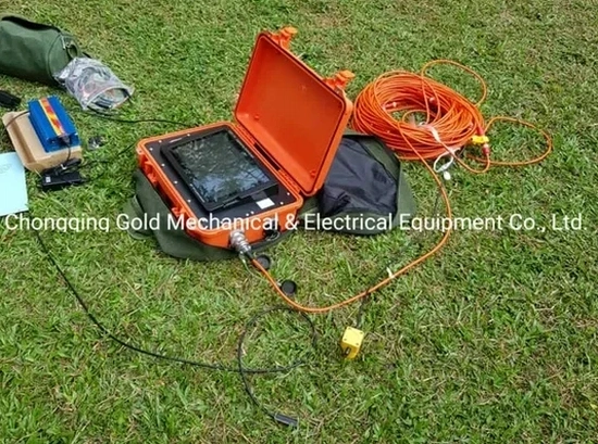
The field setup uses a 48-channel seismograph with 4.5 Hz geophones spaced between 2 and 5 meters, depending on target resolution. An accelerated weight drop or sledgehammer source generates the seismic signal, and the team records multiple shot points along the spread to build a dense ray coverage. In Tucson's dry surface conditions, coupling is critical—each geophone is planted in a shallow augered hole and firmly tamped to ensure consistent ground contact.
Data processing runs through inversion algorithms that iterate from an initial 1D model to a 2D velocity section. The final deliverable includes a color-contoured P-wave velocity profile with interpreted geologic boundaries, plus a Vs profile for site classification when S-wave data is collected. Resolution typically reaches 1 to 2 meters in the near-surface, sufficient to delineate cemented caliche horizons that affect excavation costs and footing bearing capacity.
Quick answers
How much does a seismic tomography survey cost in Tucson?
Survey costs in Tucson typically range from US$2.350 to US$4.940 depending on spread length, number of shot points, and whether both P-wave and S-wave data are collected. A project-specific quote is provided after reviewing the site location and investigation depth requirements.
What depth can seismic tomography reach in Tucson basin sediments?
Depth of investigation depends on the geophone spread length and source energy. For refraction tomography, the rule of thumb is 15% to 20% of the total spread length—a 100-meter line typically images 15 to 20 meters deep. Deeper targets may require reflection methods or crosshole tomography between boreholes.
Can seismic tomography detect faults beneath a building pad?
Yes. Velocity contrasts across fault zones appear as lateral gradients or offsets in the tomographic profile. In the Tucson basin, where Quaternary faults are often buried by young alluvium, seismic tomography is one of the few non-invasive methods capable of resolving these structures before excavation begins.
How does the survey data help with IBC site classification?
The IBC classifies sites from A (hard rock) to F (problematic soils) based on the average shear wave velocity in the upper 30 meters (Vs30). Seismic tomography provides a measured Vs30 value, which often results in a more favorable site class than the default assumptions—potentially reducing seismic design forces and foundation costs.